Ken Moodie, Principal of Creative Golf Design Ltd, explains how they are applying techniques used for their golf course audits to provide golf clubs with a new service.
When it comes to planning and mapping improvements to their golf course, many golf clubs are now using on-line aerial photos for this purpose, but few have the capabilities to scale these accurately. They are also unlikely to have any accurate height or contour data to link with these images, which is particularly useful when planning drainage improvements and irrigation storage ponds. It is also important for health and safety purposes that things are mapped accurately, particularly when it comes to installing and locating underground services and electrical cables.

LIDAR Mapping
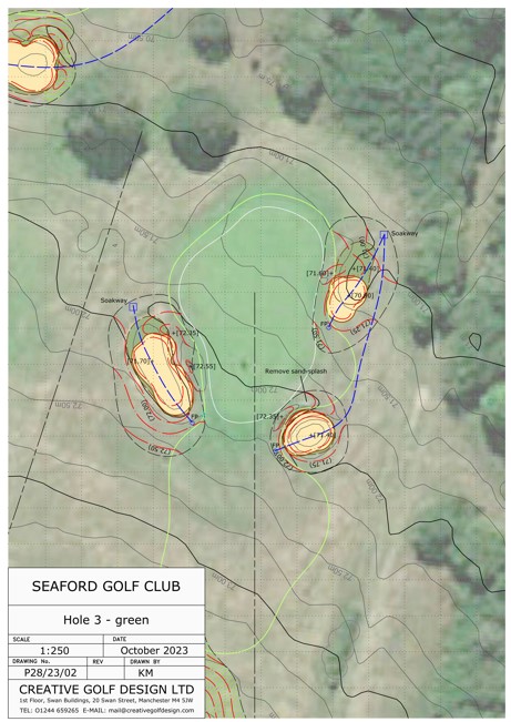
Using specialist software, Creative Golf Design is now offering a new service of LIDAR mapping of golf courses which provides a cost-effective solution for golf clubs requiring accurate plans and contour information, at around a tenth of the cost of a traditional topographic survey. LIDAR data consists of a grid of levels at a typical spacing of 1 to 2m, accurate to just a few centimetres, which is gathered by the Environment Agency in England (and equivalent bodies in Scotland and England) for flood planning purposes. CGD can access this information and use it to generate contours which can be combined with Google Earth or other aerial imagery.

In terms of delivery, a range of options can be provided:
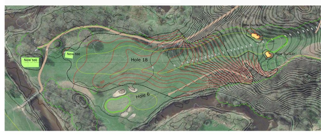
- A contour map of the whole golf course in PDF format, using a recent aerial photo of the course as a backdrop, at an agreed scale of 1:1000 or 1:1250 which is ready to print on an A1 or A0 sheet. The plan would incorporate the number and centrelines of each hole, and features such as the clubhouse, maintenance compound and practice area would be annotated. Contours can be provided at any interval that is requested, but would typically include 0.25m minor, and 1m major, contours. Dwg or dxf files, and printed copies of plans, at any scale, can be provided on request for a small additional fee.
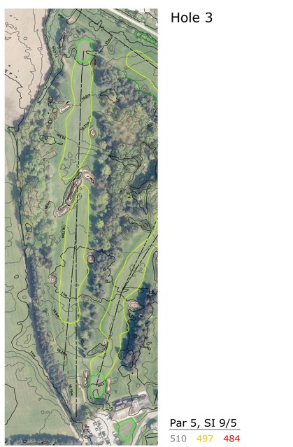
- Individual plans can be provided for every hole on the golf course at A4 or A3 size, at an agreed scale, with a grid superimposed if required to make measurements easier. Normally a space for notes and annotations will be included to the right-hand side of the plan, so it can be used in the field for planning course improvements such as tree work, fairway reshaping, new tees and paths, bunker alterations, drainage and irrigation installations, etc. Basic information on each hole can be included on the base plans, such as the par, stroke index, and the lengths from each of the tee markers.
- Enlarged plans of any area of the golf course at an agreed scale.
- Updates to the plans in the future to record new installations which are provided in a digital format.

The CGD team is happy to tailor plan to suit the individual golf club and provide a truly bespoke solution. The basic package is priced at just £950 & VAT.
Once the topographic plan has been created, CGD can offer a range of complementary services including:
- Maps showing water catchment areas and surface water flows
- Identification of water collection hollows
- Drainage plans
- Contour plans for water storage lakes and ponds
- Design plans for a range of course improvements including those utilising imported fill for reshaping driving ranges, practice areas and other parts of the golf course
- Accurate calculation of earth-movement volumes
- Computer-generated images and video for course improvements
- Plans, sections, maps and documentation for planning applications
Another new service which they are offering, in the UK, is the provision of historic aerial maps of golf courses using photos taken by the RAF during the late 1940s. As well as providing a source of valuable historic data, it can be used to create an attractive framed picture within the clubhouse to make members and visitors aware of the golf club’s unique heritage.
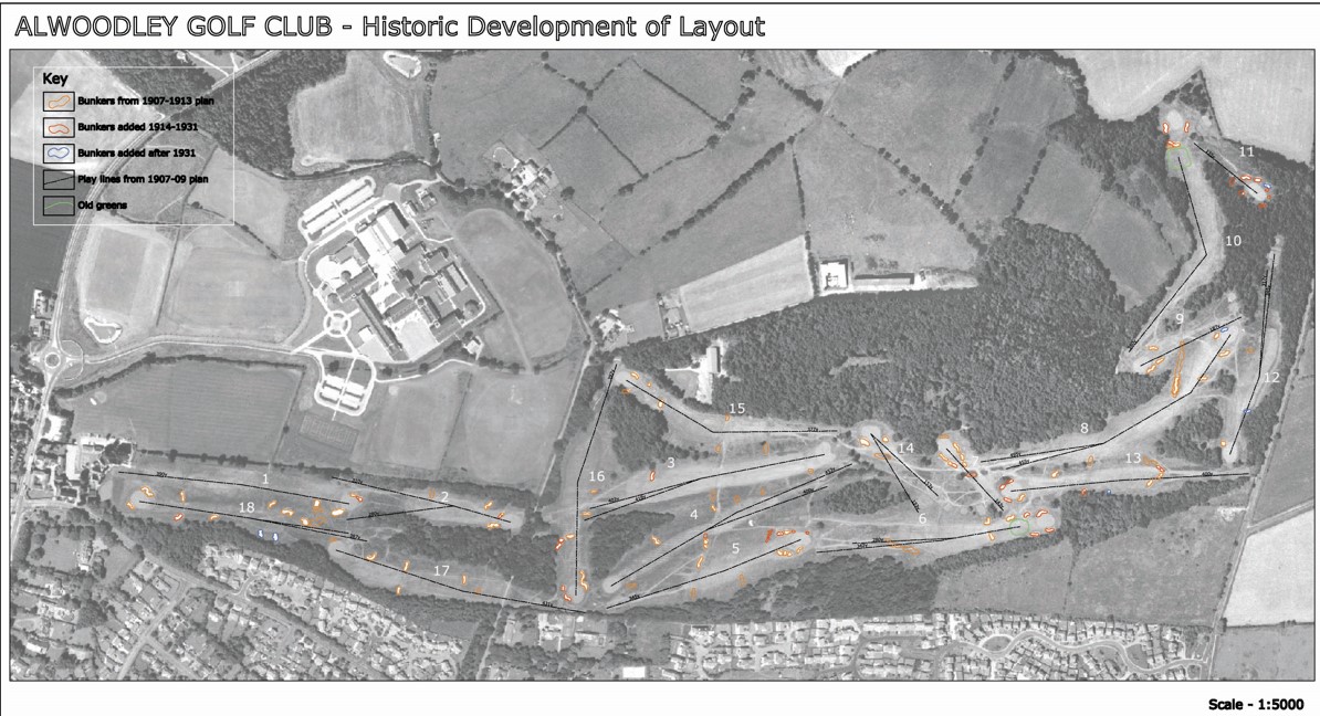
The CGD team has utilised this source of historic information many times when planning course improvements at classic golf courses such as Royal Blackheath and Alwoodley, where historic changes for the golf course were mapped and analysed. The company also won the prestigious Renovation of the Year Award from the American GolfInc Magazine for their work at Moortown, and historic aerial imagery was used as a valuable reference to restore much of the original bunkering on this classic Alister Mackenzie design.
For further information, please contact ken@creativegolfdesign.com

