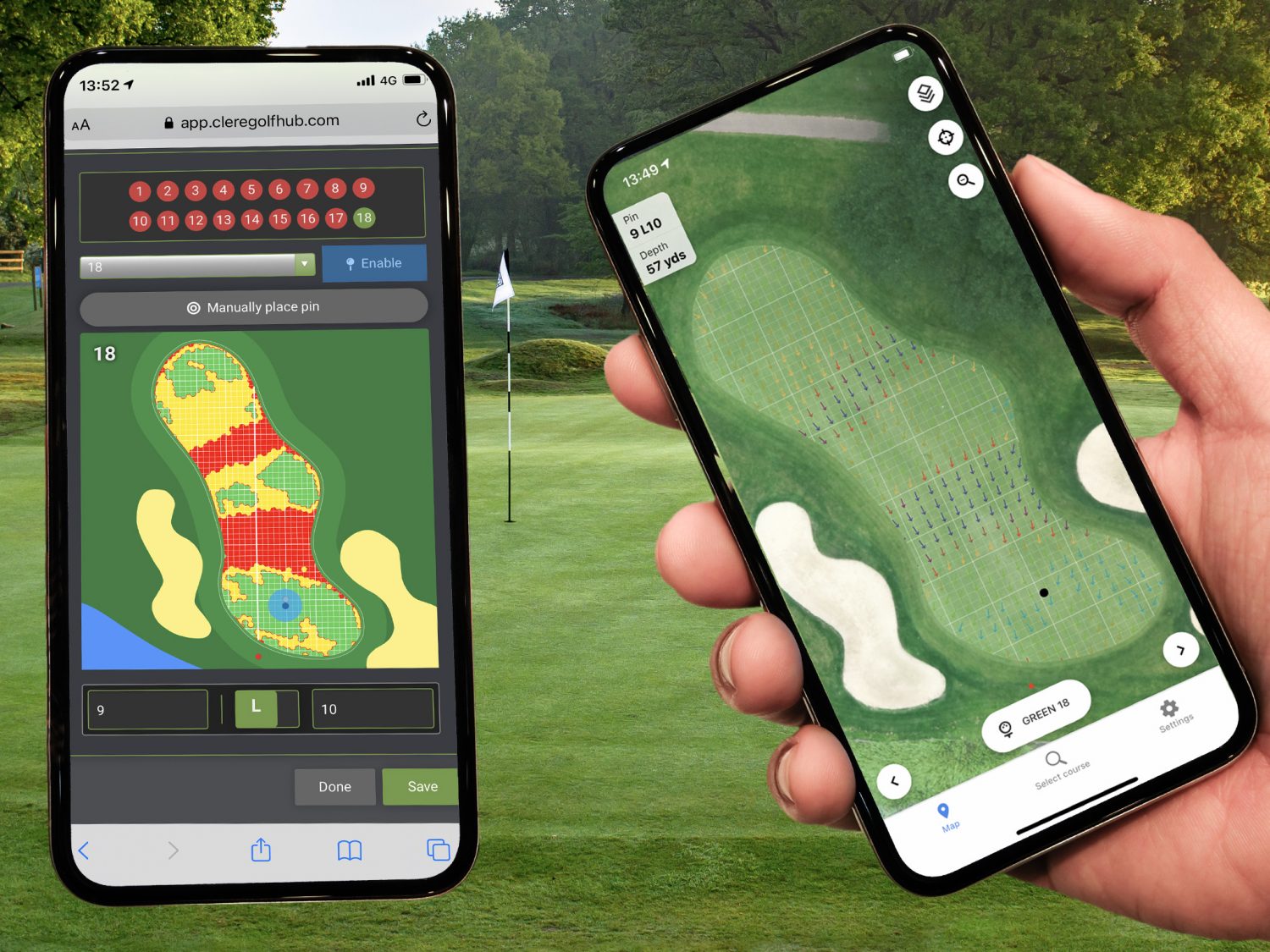
The next generation pin location system is here….. Golf’s most advanced yet straightforward pin location system is available through Clere Golf.
Pin Locations are easily accessed through an Android and IOS PlayerApp or by using traditional printed sheets in a variety of formats.
Setting pins is straightforward. Simply walk to the location of the new pin and ‘place’ its precise position at the click of a button using the systems mobile interface which ensures normal working routines are not disturbed.
With a system underpinned by mm accurate 3D laser scans all slope data is visible on your desktop enabling pins to be conveniently created in advance by users safe in the knowledge they are being placed in ‘legal’ areas where green slopes are not too severe.
Clere Golf’s PlayerApp offers a modern convenient solution for golfers to access precise pin information with speed and efficiency whilst reducing the administrative burden that clubs having faced in the past when printing and preparing pin sheets in the traditional way.
The powerful system already adopted by numerous venues including Roehampton, Hillside and Berkhamsted will enable pins to be categorised at the time of placement for analysis in months and years to come.
“My goal was to improve the member experience across our competition calendar without adding an administrative burden to our team, the Clere Golf system has enabled me to do that and through the PlayerApp it offers something I’ve not seen available anywhere else” said Howard Craft, GM at Berkhamsted. “We are trying hard to cater for a new and younger breed of members whose expectation and demands are different to those of years past, the technology we now have in place really supports those efforts thanks to the PlayerApp”.
Learn more about Clere Golf’s ‘PinZone’ system here.
This Pin Location functionality forms part of a much broader web-based software product developed by ClereGolf over the past 18 months.
For years valuable information relating to a golf course has been stored in folders, mailboxes, databases or the memory bank of staff. The problem here is recalling the data when it’s really needed or using it proactively to solve a problem before it becomes one.
Clere Golf have combined superior surveying capabilities with cutting edge technology and know-how and built a geo-spatial HUB where data can be recorded, shared and reviewed against a present-day high-resolution survey of the golf course.
In simple terms you can navigate around the golf course on desktop while in the office or mobile while walking the course and record any instance you wish. These instances or ‘geo-records’ as they are known can be supported with photographic evidence, categorised and even converted into tasks and tracked.
“We travel the world gathering highly accurate data in order to produce the various products our customers require, it just seems sensible to give them access to that data in a format which will help them manage their greatest asset” said Steve Richardson, Director at Clere Golf.
Every club records on-course activity such as trees that have been felled, incidents of pest or disease across greens and fairways or planned activity for a winter program but the HUB takes this further by enabling all data to be stored against a map of the course in such a way that it can be recalled and filtered in real-time.
All of a sudden teams can collaborate easier than ever before. For example, if you are out on the course and see some damage to a bunker or pathway, you can use the mobile app which will record your precise location to take a picture, record the incident and store it on the HUB for action and review at anytime from anywhere.
The HUB can also house data pulled from external sources such as irrigation plans which can be displayed against the ariel survey. Standard tools enable users to easily measure distance and area with great accuracy and part of the systems intelligent set-up ensures that the surface area of key features such as greens, tees, bunkers and fairways is displayed ‘out of the box’.
“These days we are much more than the company that produce the course guides and scorecards, our team includes software developers, geo-spatial engineers, experienced surveyors and project managers who can deliver systems that make a genuine difference to the day to day running of a business” Steve explained.
“Uptake has been incredible as there really is nothing else quite like it and nothing else that can deliver value to all facets of a golf club. As an on-line product it’s also very easy for our team to demonstrate remotely”
The cleregolfHUB is being used by Course Managers, Greens Committees, Club Managers and Tournament organisers who all find value in what it can offer. Visit http://www.cleregolfhub.com or download the cleregolfHUB brochure to find out more. For a demonstration via either a visit or video call at a time that suits, call the our team on +44 (0)1635 43026.


